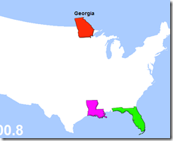
Statetris-USA is a fun little game modeled after Tetris - that teaches you exactly where each state is located in the US. (I got many of the eastern states wrong!)
Thursday, May 29, 2008
Google Earth mimics Virtual Earth
When Virtual Earth was first released, I could not understand why Microsoft decided to make their 3D viewer a browser plugin instead of a stand-alone application like Google Earth. When VE was released - it was slow and clunky and Google Earth was my favorite 3D GIS application. But slowly I understood the idea behind Virtual Earth and found that I used it more and more. I like the fact that as a developer I can provide web users a seamless experience of moving from 2d maps to 3d maps. It made for a much more compelling user experience. Also - after flying through your city and to my home a 100 times - I found that I mostly used the 3D viewers to find addresses and get a feel for the streets of a new location I was going to visit. For that sort of quick look - I like using the browser based viewer - as it is much more quicker to load, view and navigate away from.
Google obviously agrees that the Virtual Earth idea is a good one = as it has now made GoogleEarth available as a browser plugin too (http://code.google.com/apis/earth/). Which possibly could mean that Google Earth is a superior product now - as the user can decide if they would like to use the stand-alone viewer or the browser based viewer. Now to wait and see if Virtual Earth will also be released as a stand-alone product in addition to the browser based plugin that it is currently. (An easy task as the Virtual Earth viewer is a separate control that one can even today embed into a WinForms window with a little hacking).
Get the Google Earth Plugin now (windows only).
Google Earth API - Google Code
Samples built using this new API are available at - http://code.google.com/apis/earth/documentation/examples.html
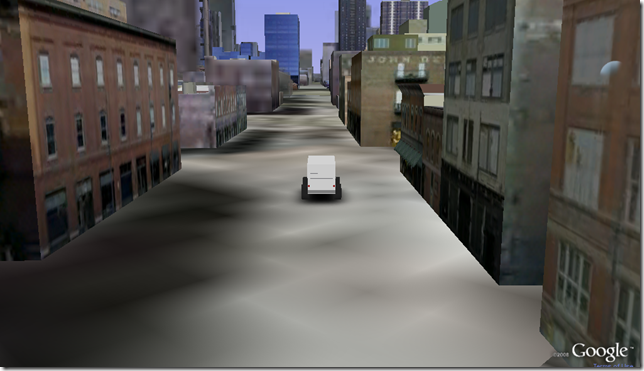
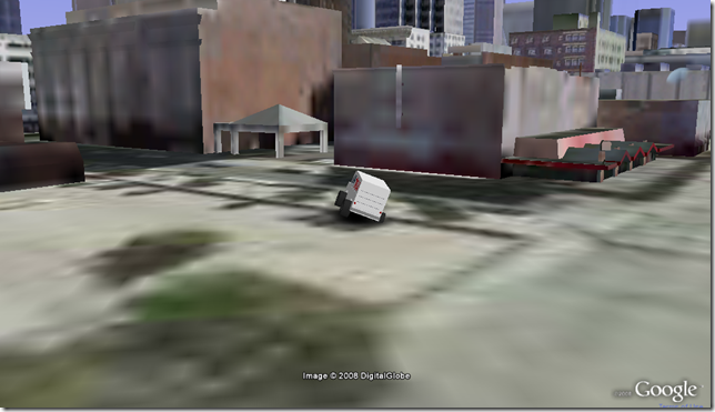
Have a couple of minutes to spare - install the plugin and then drive the Monster Milk-truck through all kinds of places - its FUN!!!
Milk Truck in Denver
Tuesday, May 27, 2008
How-To: Expand your camera with CHDK - Hack a Day
How-To: Expand your camera with CHDK - Hack a Day
The Hack a Day website has information on how to expand your camera with the CHDK firmware hack. Unfortunately the hack works only on Canon cameras. But the features that it adds (scripting, advanced features like higher shutter speeds, raw formats, etc.) make me wish that I had gone for a Canon camera instead of the Nikon.
The following video (shown on the Hack-A-Day site), was made using a script to take pictures once every 15 seconds.
If you have a Canon camera - definitely check out the CHDK camera firmware hack. The best feature of the hack is that it is completely reversible and so you don't have to worry about bricking your camera.
The Hack-A-Day site and LifeHacker have very good posts on using the hack. The Chdk site is at http://chdk.wikia.com/wiki/Main_Page and Canon camera models supported can be found at http://chdk.wikia.com/wiki/FAQ#Q._What_camera_models_are_supported_by_the_CHDK_program.3F.
Thursday, May 22, 2008
What format do you use when you compress files
I have always by default used the ZIP file format whenever I have needed to compress files. Never gave it a second thought as I have been using ZIP files for archiving since the days of PKZip/UnZip (at least 17 years).
That was until a friend of mine (Josh Morey) from work told me to use *.7z. And he pointed me at the following page to prove his point Comparison of compression methods.
Sure enough it turns out 7z leads to higher compression ratios. (For example on a LAS file - a LiDAR point cloud containing binary data - the original file was about 73 Mb. The ZIP format lead to a compressed size of 40mb and the 7Z format lead to a file size of 29mb). It does seem to run slower than when I zipped the file, but to me compression ratios are more important that processing speed.
His recommendation for software to use - 7 Zip and iZarc. I like 7 Zip, as it has a good set of context menu options - which is important to me (I hardly use the full UI to perform my compression and decompression work). He likes iZarc as it has a release that is portable and can be run off a USB drive.
Whatever you choose - bottom line - if you have been using ZIP by default, then its time you took a look at the newer compression algorithms. http://en.wikipedia.org/wiki/Comparison_of_file_archivers
Thanks to Josh on setting me straight on the path to reduced bits.
SOLA G2 - KMZ Converter for Google Earth
SOLA G2 is a convertor that allows you to take some of the major 3D model file formats and convert them to a KML representation, so as to be able to load the models into Google Earth.
There is a free version of the software available. The file formats supported are:
- Autodesk *.FBX (2006.11)
- 3D Studio *.3DS
- Wavefront *.OBJ
- Autodesk *.DXF
- Collada *.DAE
BIGGEST DRAWING IN THE WORLD
The story goes that an art student put a GPS tracking device into a suitcase and then shipped it using DHL with clear instructions as to what route the package was to take. The result was that the track that the GPS recorded was a self portrait of the artist. The image shows the trace of the route on a world map.
But is it a hoax or is it for real?
I am not sure - my only problem with this story is:
My GPS device fails to work even a couple of feet away from the window. So I am not sure how this guy's GPS device was able to get good readings from inside a padded suitcase sitting in the cargo hold of a DHL plane. Also - the minute I enter an area with tall buildings, the GPS starts getting all crazy with all the reflections of the GPS signal - that should have been a much bigger problem inside the cargo hold.
Here is a video by the author.
It would have been cool if the artist had published a KML file of the route - so that we could easily determine if DHL flies to all the locations traced by the drawing.
Monday, May 19, 2008
Visual Studio and .NET Framework Hotfix Public Availability Program
Microsoft has finally made it easier to obtain hot fixes for Visual Studio and the .Net framework. Where one would have to call in to a call center and spend at least 30 minutes or more on the phone getting a hot-fix, one can now directly download it from the Connect website.
Microsoft Connect (for Visual Studio and .NET Framework)
According to MS
The goal of this program is to provide customers with direct access to the most popular Hotfixes for Visual Studio and the .NET Framework. A Hotfix is a product update package with one or more updated product files that fix a specific product problem.
Friday, May 16, 2008
3D Flash LIDAR Vision for Robots
YouTube - 3D Flash LIDAR Vision for Robots, UAVs, UGVs
Example of a flash LIDAR system being used on a robot by iRobot.


