I uploaded 2 videos to YouTube today that was in response to question from a user of LIDAR Analyst.
They describe how to set up visualization of the DEM and Bare-Earth DEM in ArcGIS. Instead of the default option of creating a RGB hill-shade raster this technique keeps the DEM and Hill-Shade rasters separate.
There are two major reasons that I prefer this method (instead of the RGB raster):
1. You can customize the coloring. This allows you to choose a color ramp that brings out the details in your DEM.
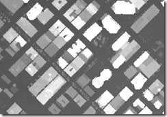 DEM without hill-shade - looks flat and it is hard to make out features
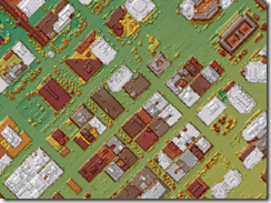
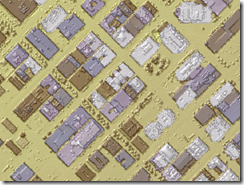
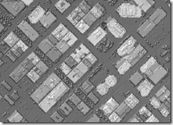
Above: DEMs colored using 3 different ranges with hill-shade rasters providing a psuedo 3D look - making it easier to see detail. (Color changes was done by simply changing the color-range associated with the symbology of the DEM raster).
2. You can query the DEM's elevation values. (With the default option - you will only get the RGB values).
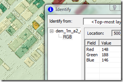 Querying of the default hill-shade raster doesn't allow you to determine elevation values because the hill-shade raster is a RGB image.
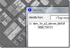 Querying of elevation values is possible, when DEM and hill-shade are kept separate.
Obviously the downside is that - you cannot get the colored visualization in other GIS applications. (So if you want to view the hill-shade in Imagine, you should output to one of the other options).
Visualization of DEMs in ArcGIS - shows you the technique for visualizing any DEM raster.
Visualization of Bare-Earth DEMs is basically the same steps as shown above, except shows the colors that make most sense for bare-earth DEMs.
The bare-earth was automatically extracted using LIDAR Analyst for ArcGIS. Hill-Shade rasters were created using LIDAR Analyst.

5 comments:
I salute you !!! Nice and Good Information about Lidar Analyst and you right ... Lidar Analyst is a 3D feature extraction solution for airborne LIDAR data, supporting Homeland Security, Defense and Intelligence, Forestry, and other vertical markets requiring high-resolution terrain information. What can I add more? Awesome !!!
Thanks for this info.. but can you send me more about its advantage and disadvantage? If I am not mistaken, google earth use lidar analyst?
I am not expecting Visualizing DEMs in ArcGIS using LIDAR Analyst will give that nice result. Thanks for this presentation. I am satisfied on what I read.
I got so curios about Lidar Analyst... imagine?! bare-earth was automatically extracted using Lidar Analyst? I will make a follow up research about this.
I love this one. It adds my knowledge in Lidar Analyst. According to what I read, Lidar Analyst extensions for ArcGIS is a necessary tool for anyone who has Lidar Data.
Post a Comment