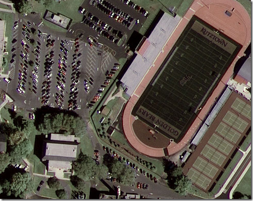
This is the first image from the newly launched satellite GeoEye-1 that has been released to the public.
GeoEye-1 simultaneously collects 0.41-meter ground resolution black-and-white imagery in the panchromatic mode and 1.65-meter color (multispectral). This first image showing Kutztown University located midway between Reading and Allentown, Penn. was produced by fusing the satellite's panchromatic and multispectral data to produce a high-quality, true-color half-meter resolution image. Though the satellite collects imagery at 0.41-meter ground resolution, due to U.S. licensing restrictions, commercial customers will only get access to imagery that has been processed to half-meter ground resolution.


No comments:
Post a Comment