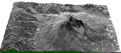
 A good article from ESRI’s mapping center on best practices for working with raster elevation data-sets (DEMs). Mapping Center.
- Manage DEMs in their native geographic coordinate system
- Standardize names of your DEM files so that it is easy to determine units and point spacing
- Always keep an original copy of the DEM .in the original geographic coordinate system. Use this to create any derived data-sets in a new projected coordinate system.
Some points that I would add:
- Get your provider to provide you with meta-data about the DEM data-set. One of the most important pieces of information that you should get is the point spacing that was used to capture the data-set. Knowing what the point spacing was, allows you to determine what sort of work you can do with the DEM. (eg: you cannot get buildings out of DEM that was captured with a point spacing of 2 meters).
- When creating tiles – try and cut the tiles such that they are homogenous in the kind of features that they contain:
eg: don't cut a tile such that one portion contains an urban center and the other contains mountainous terrain or dense forests. This is because when you perform geo-spatial analysis – extracting features will become difficult as you will need to use different settings on these different types of geographic features. - If you are going to get elevation data – then try and get it with the original point cloud. Having the original data from which the DEM was created will allow you to use the widest set of tools for processing your data. (Also, most new algorithms that come out are based on processing point clouds as they have a lot more precision).
But remember, just because you have a DEM, or you are using a raster based algorithm for feature extraction – you aren’t working with less precise data. Precision in derived data from your elevation datasets is based on the features you are trying to extract. (eg: bare-earth and most building footprints can be extracted from DEMs with a comparable precision to that of bare-earth and building footprints extracted from point clouds).
LIDAR Analyst has proved time and again in many studies – that you can have a high degree of precision and accuracy when processing and extracting features from DEMs. - If you are getting new data – attempt to get the lowest point spacing that you can afford. Even if you dont need it for your current application. I have seen many times where organizations get lower resolution data which is cheaper and maybe sufficient for the current work that they are doing, but useless a year later when they try to use the data for some other purpose. (Most often the case is that LIDAR data was acquired for performing flood modeling for which 2 meter point spacing or higher can work, and later when they try to extract building foot-prints – the data is pretty much useless except for the larger buildings).
- Learn to setup your DEM for visualization with a hill-shade layer in traditional GIS applications. (In ArcGIS, this involves setting the DEM layer to have a transparency and has a hill-shade layer below it). This can make a world of difference in being able to differentiate and find objects visually.

No comments:
Post a Comment